We paid $700 for a snow removal service that hasn't come once, and local golf courses are opening. On January 30th.
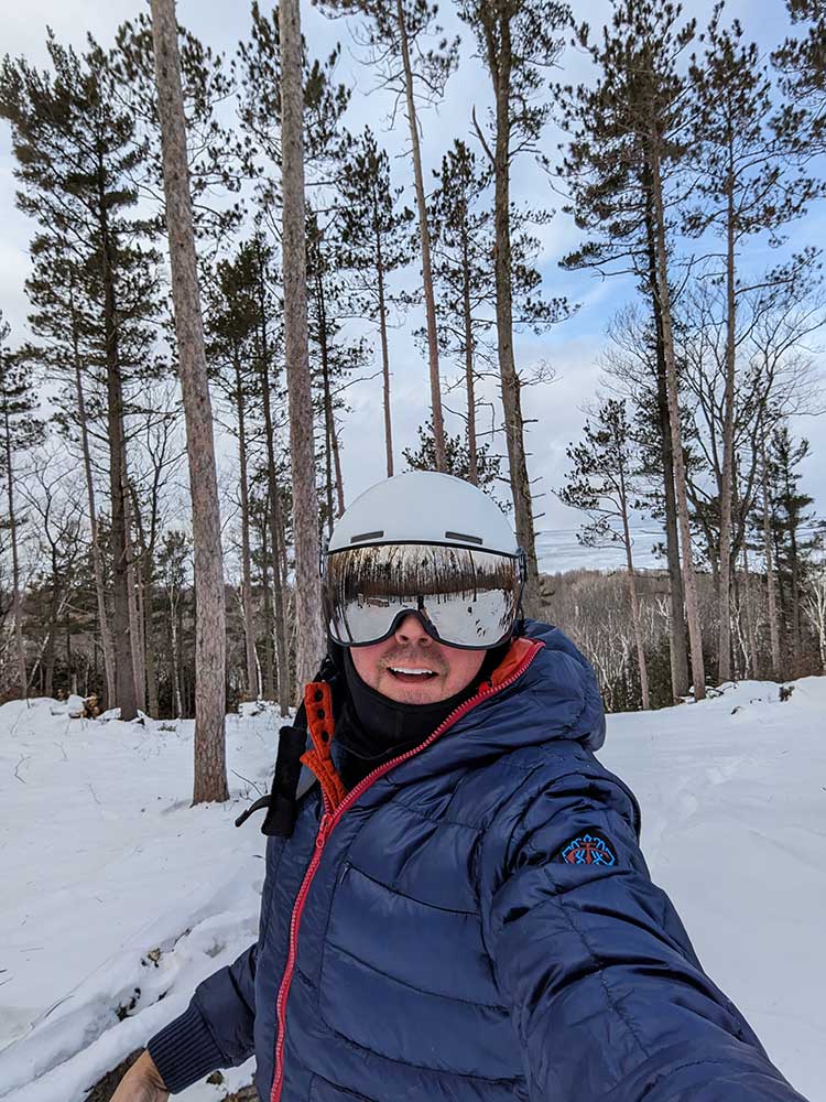
But Door County, WI got about a foot of snow on January 12th, so of course I had to drive over and take a few runs down the partially-cleared ski slope.
A few observations and takeaways:
This is still early beta.
What feels like a wide-enough trail without skis on feels like a chute when you're actually skiing down it.
Confirmed: bump skis are awful in 12" of pow.
A rope tow is a mandatory requirement.
A guy can get shin bang *real* quick hiking up a hill in ski boots.
There is an incredible amount of work ahead that almost certainly requires the purchase of a Bobcat.
The full release might be delayed until winter 2025-26.
Due to several factors beyond our control, we decided to delay starting the MVC (Minimum Viable Cottage) build until 2024.
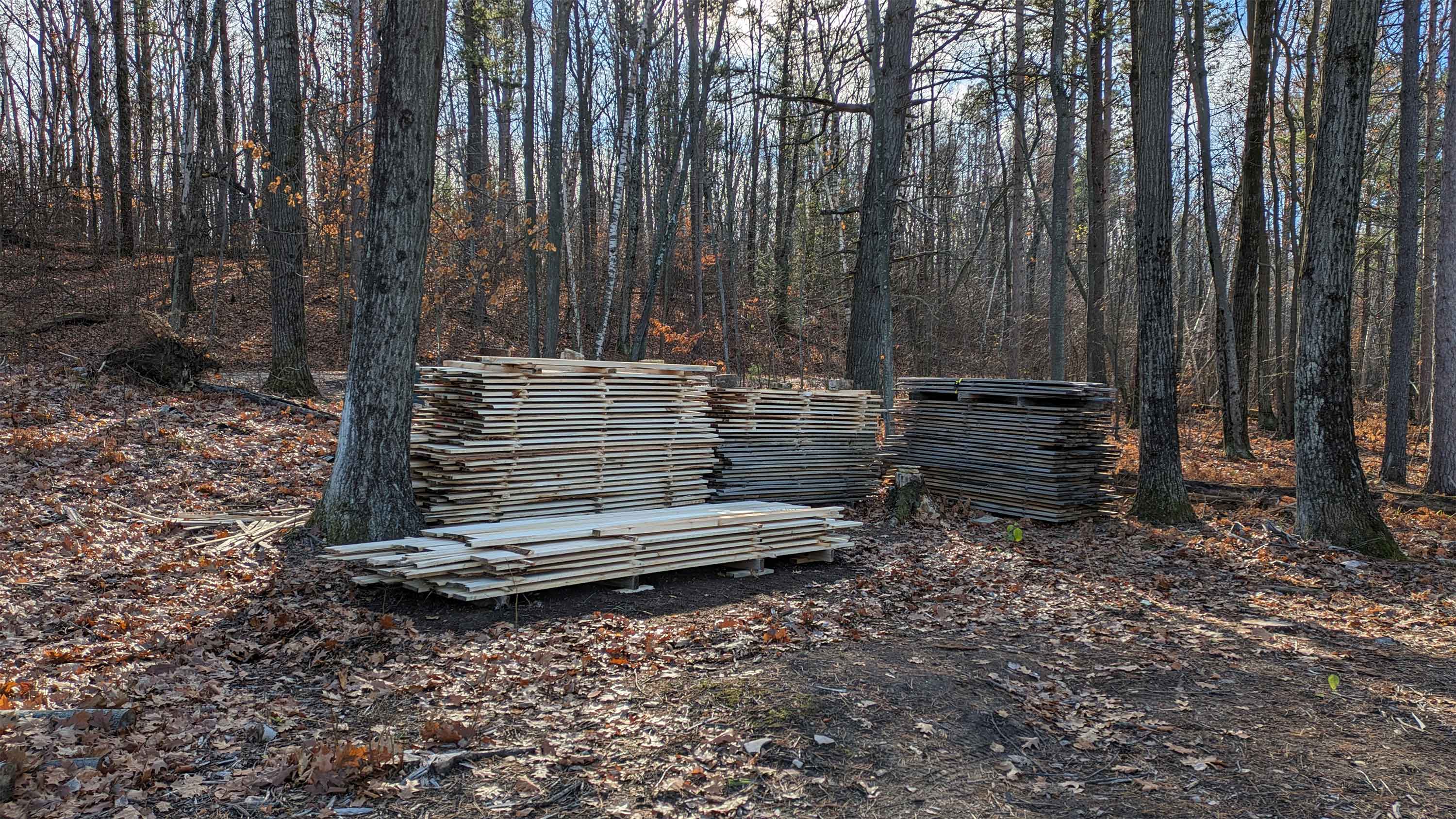
What this means for you, dear reader, is a bigger focus on birds, tree felling (known as "lumberdacking" here), wood stacking and stickering, and preparations for the ski run, including rope tow hardware and engineering. It will probably also lead to at least one and possibly several more pivots on our plans for the MVC.
So, let's get to it.
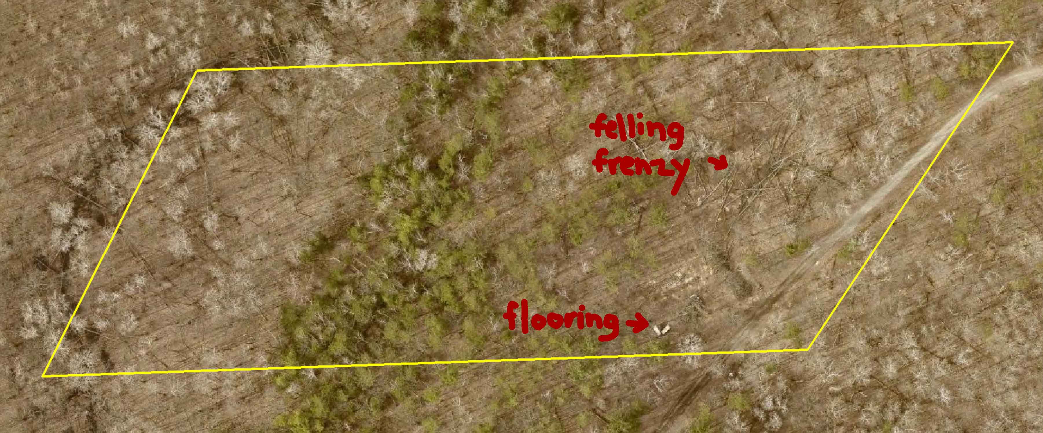
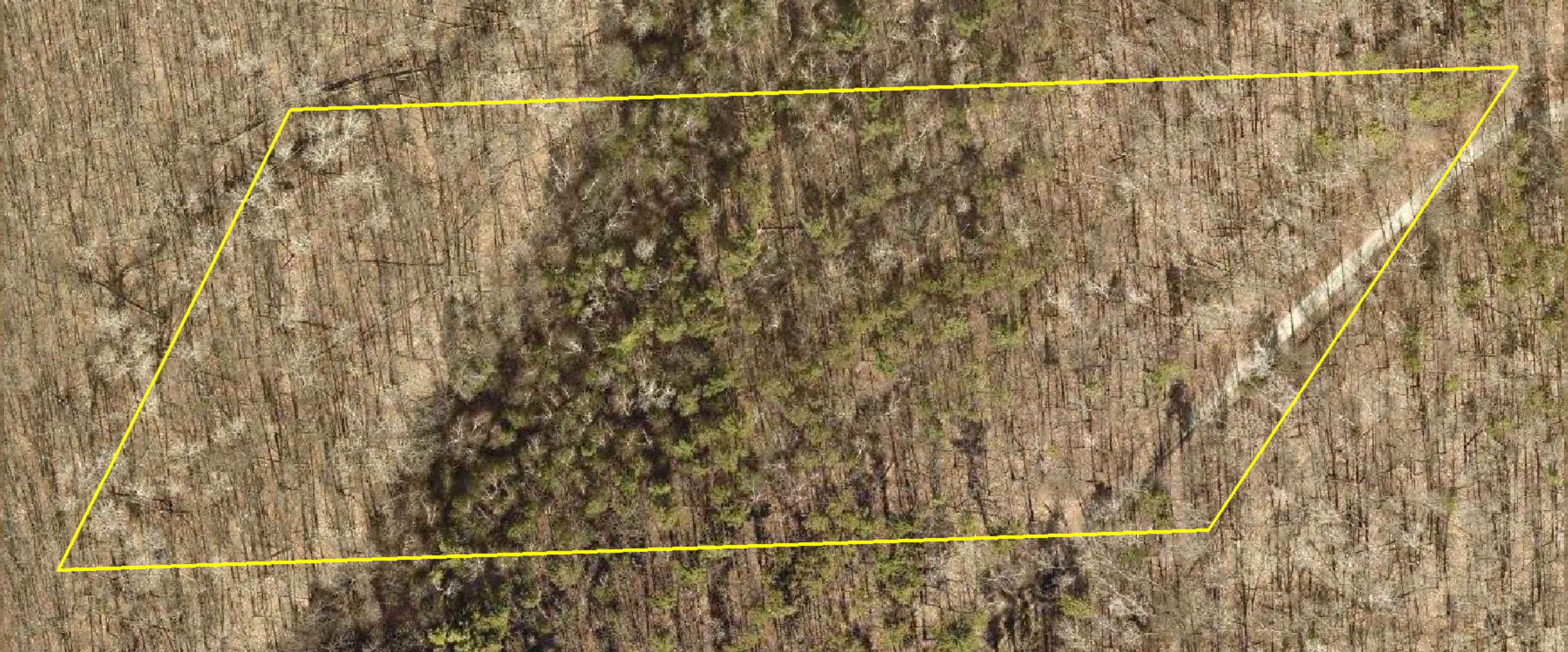
Here's the entrance to the back bowl. This initial run has been cleared down to the gorgeous white pine in the distance, which is about 250 feet long with 65 feet of vertical drop. It's roughly the halfway point. It's ready for ❄️. Anticipating that I flagged some of the bigger stumps and rocks I couldn't remove by hand.
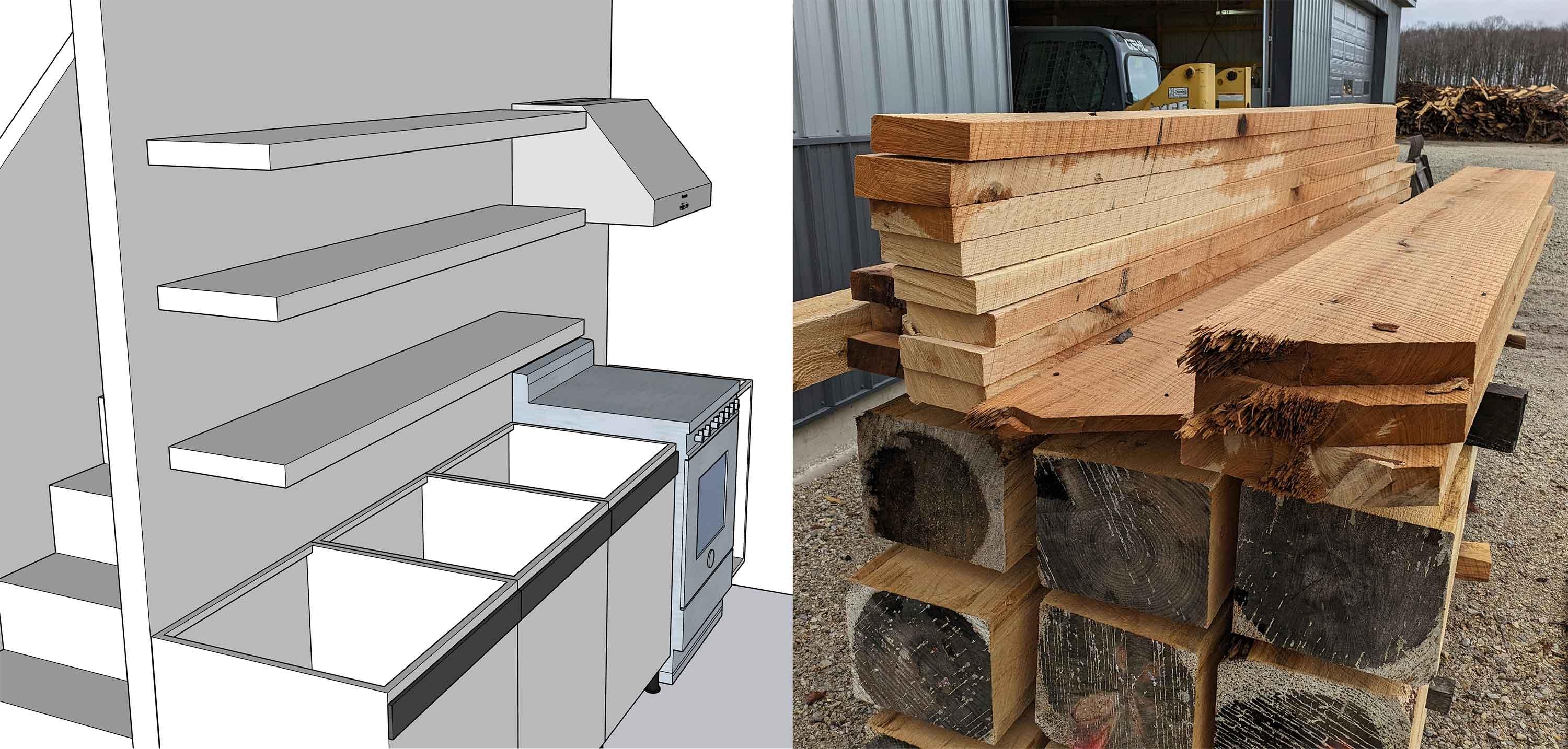
Here are our kitchen shelves, along with the some 6" stock for our pocket door slabs. The initial idea was to have these being floating shelves, but 2" x 12" solid oak will demand beefy steel brackets (and probably a steel-reinforced wall).
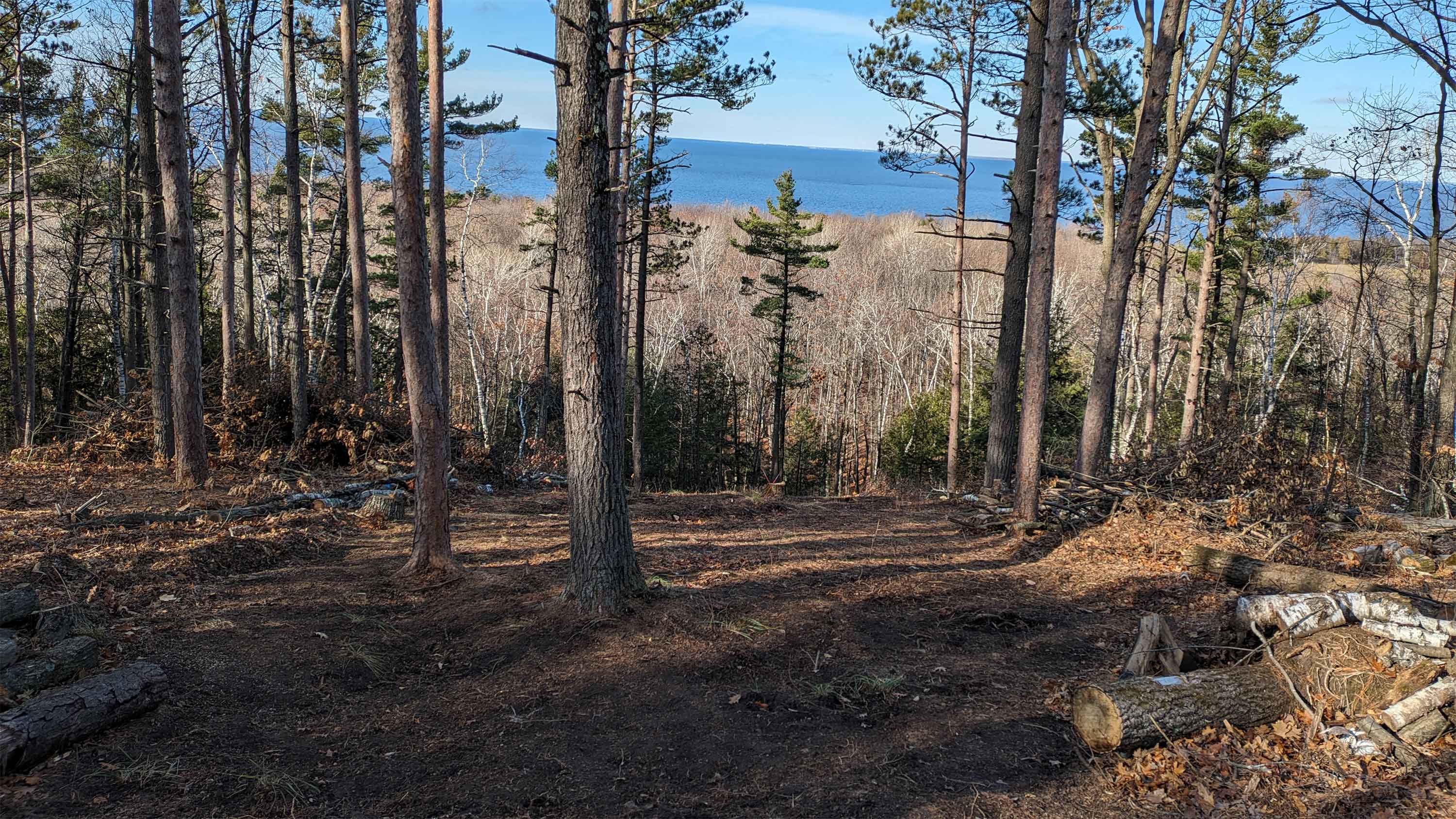
This is a full v2.0 release, with substantially fewer trees and underbrush, and I even raked part of it to expose rocks and stumps, which I then removed. With even a couple inches of snow this section is ski-ready.
The biggest pain point now: how to get back up.
A Doppelmayr quad is out of the budget. A T-bar, too. So that leaves a rope tow.
Towpro sells a full backyard lift system but it's the equivalent of about 7 seasons of IKON passes. The DIY kit is 3.5 seasons. And these are portable, whereas mine can be fixed. I may be forced to start learning about electric motors, worm gear reducers, and variable frequency drives.
I still spend a lot of time on the Door County Land Information site, looking at our lot's elevation contours (for the ski run, of course), easements, road setbacks ... and just seeing our name legally attached to a piece of the peninsula.
After doing a little more digging, I learned that this picture is taken in early spring every two years, so I got lucky putting some human activity on camera. Two years from now, hopefully, the MVC will be visible from space, too.
Here's the satellite pic from spring, 2021. If I had to bet, I'd say this year's picture was taking earlier in the day, with the shadows being cast to the west (the left of the picture). The 2021 picture has shadows casting to the north (the top of the picture).
This video turned out not quite as I imagined, but it's passable to post here as a preview to Door County's only ski run, coming sometime in 2024.
It was recorded on December 5, 2022.
Yes, it's a tree run. Note the ancient eastern white cedars in the last 1/3 of the video.
The last 15% is a doozy; definitely a black diamond, with the possibility of Warren Miller-worthy air. But unlike almost any other part of the escarpment, where it's a cliff, skiing on our lot is a possibility.
I'll have more on Door County's downhill skiing history in a future post.
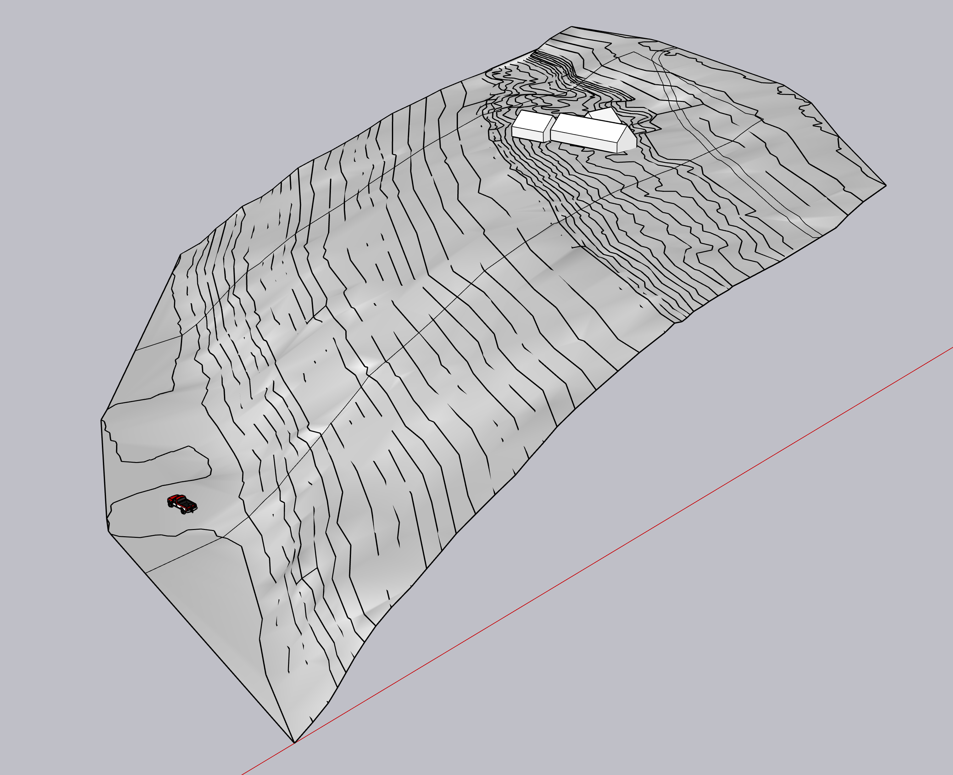
Here's the first look at the parcel, with the property lines and dead-end road draped on the topographic, and the three volumes placed about where I think they'll go.
The first build, which we are trying to get started in summer 2023, is the 36'x24' structure on the far left of the image (the northernmost volume). This is an "expandable house plan," where we will add on the larger 72'x24' house and the 30'x24' garage later, and everything will be connected via conditioned breezeways.
We just need to get a place up there ASAP, and a MVC — Minimum Viable Cottage — is the fastest, most direct route. Plus, we'll (hopefully) make all of our biggest mistakes on a very small house.
The long property lines (~800 feet) run exactly east to west. This is a view to the northeast. See full-size image
In order to make this drawing, I had to painstakingly trace elevation lines from the Door County map, elevate each of them, and then in SketchUp choose Draw > Sandbox > From Contours. Then I placed the three volumes.
It took hours but was totally worth it. Having spent a fair amount of time on the parcel, the satellite elevations are incredibly accurate. I completely trust that what's on this drawing is what's in real life.
Please note the vintage Ford pickup that's in my future.
Also please note, this plot not only provides a pretty awesome view of Green Bay, but a challenging ⛷️ run as well.
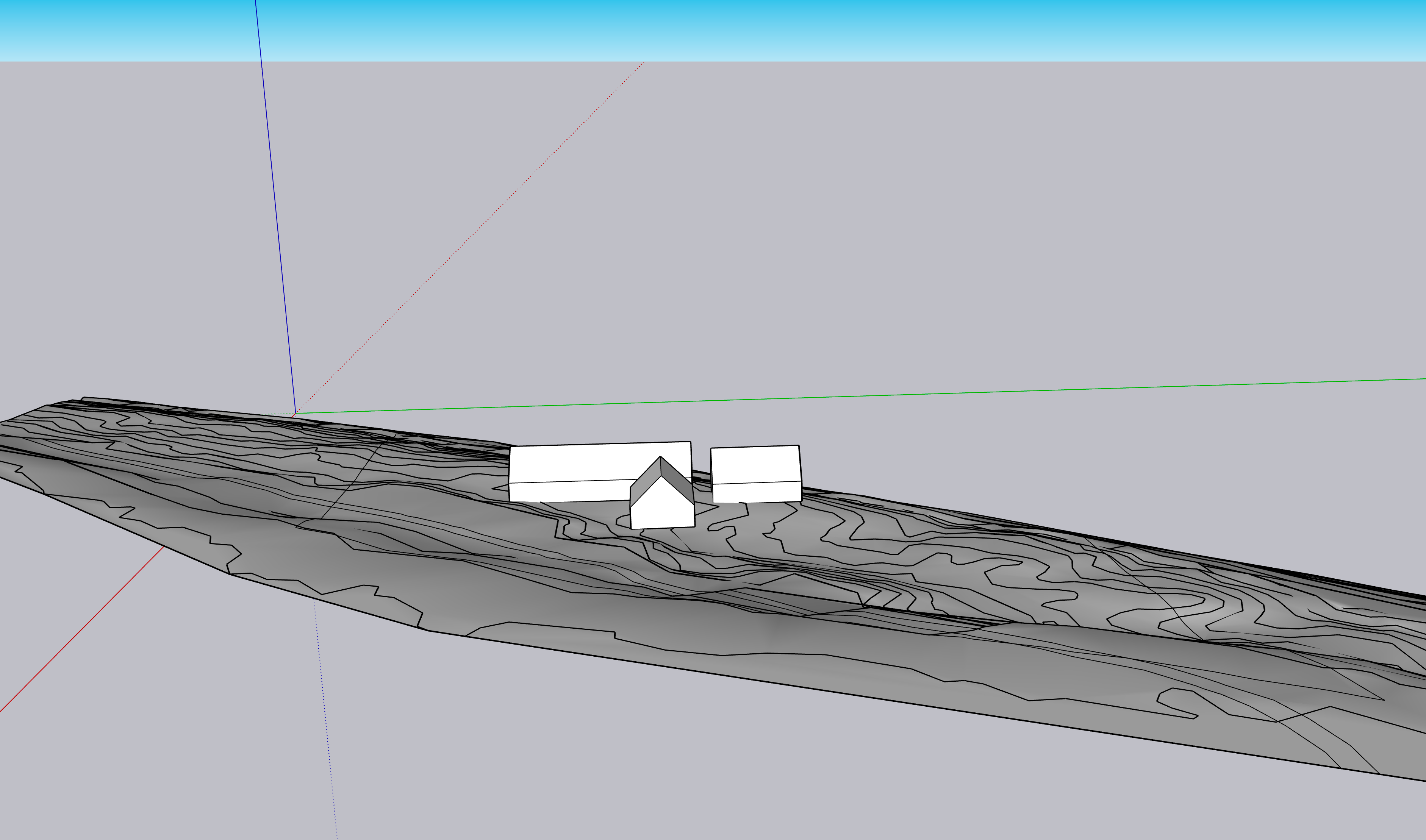
Here is another view of the drawing, with the view. This is aiming due west, and the SketchUp horizon (the blue part) is the bay.
For anyone following along, it's going to be important to see the plot of land on the high bluff where the cottage will be built.
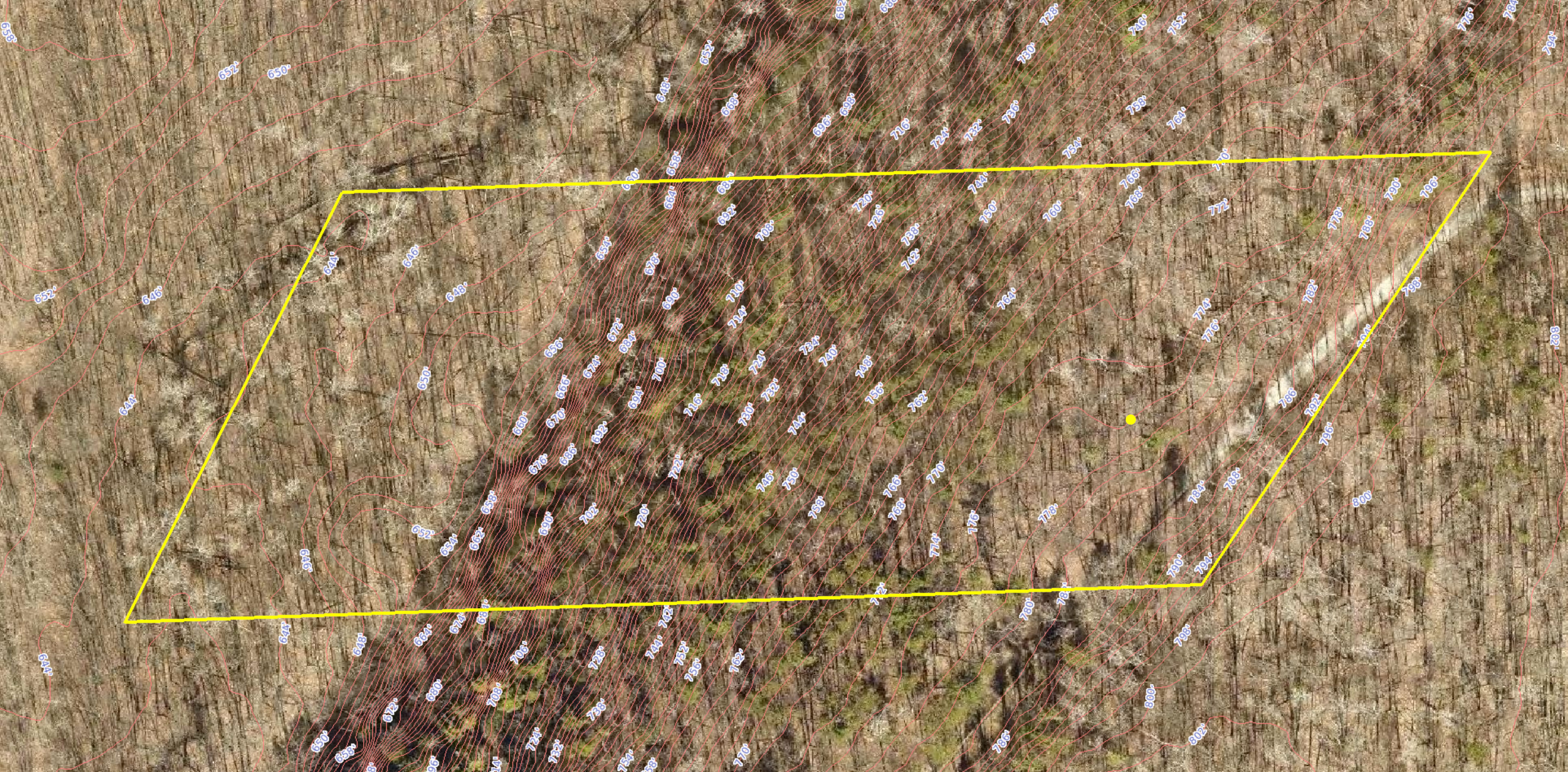
It's 785' from east to west, and 355' from north-ish to south-ish, for a grand total of 5.05 acres.
The lot is on the Niagara escarpment, which runs from about Fond du Lac, WI to, you guessed it, Niagara Falls, NY.
Below is a parcel map from the Door County site, with 2-foot elevations. The highest point on our lot is 798' above sea level, and the lowest is 644', for a 154' vertical drop. Niagara Falls' vertical drop is 160'. All we're really lacking is the Niagara River.
(I can't mention vertical drop without dropping a long-range property goal: Door County's only ⛷️ run. It's a blue-black with a big steep at the end, where the red lines are really close together.)
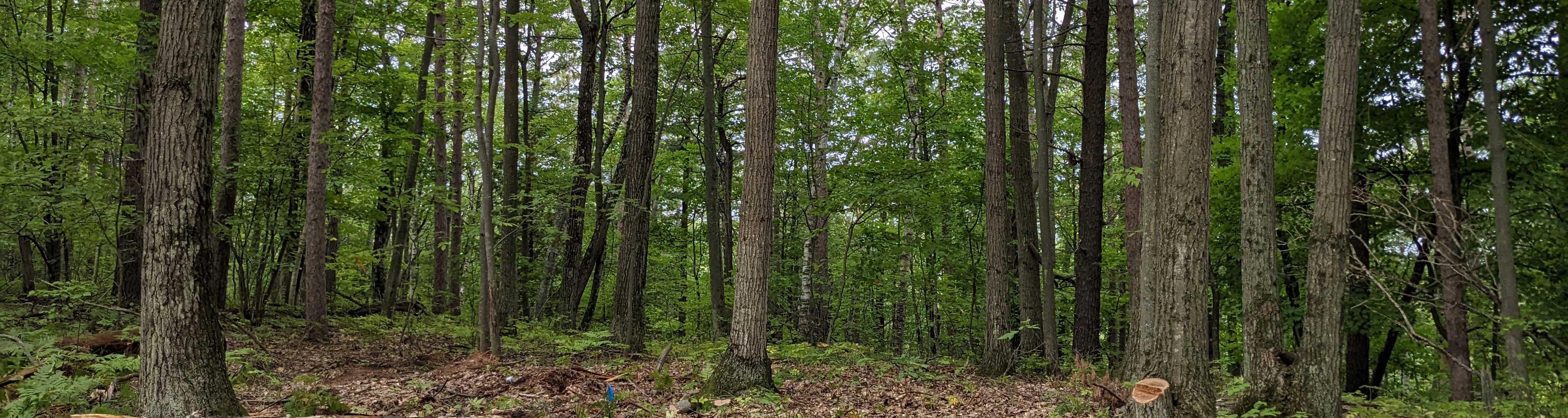
The yellow dot indicates the spot where the header photos are taken from, aiming straight west. See full-size image
As you can probably tell from the image, the best buildable area is in the southeast corner of the lot. That's the spot where the header picture will repeatedly be taken from, aiming straight west. Right now it's just trees, but at some point in the next few months a pretty killer view of Green Bay will be revealed. Stay tuned.